1. Advantages of using digital spatial data include the following: it’s the easierst, quickest, and least expensive source for much spatial data. The disadvantage of digital spatial data is that because it is so readily available, you must check the source and metadata to make sure the data is reliable.
2. You must make sure that the coordinate projection system is the one that you need to use. You should also make sure that the data was collected and assembled by a reliable source. You should make sure that you’re using the most up-to-date version of that data by checking the metadata. You should check to make sure the resolution is good for what you want to do.
3. DOQs are images that have been corrected for distortions due to camera tilt, terrain displacement, and other factors.
4. The national elevation dataset is a seamless high resolution DEM of the United States produced by the USGS. This information is derived from both ground and aerial surveys. The National Hydrologic Dataset (NHD) compines data from USGS digital line graph data and the US EPA river “reach” data to create digital spatial data about surface waters including rivers, streams, canals, ditches, lakes, ponds springs, and wells. NHD data come from both ground and aerial surveys. National wetlands inventory (NwI) data are produced through a combination of land and aerial surveys as well This data is produced by the US Fish and Wildlife Service and they portray the characteristics of wetlands, including open water.
5. DEMs, or digital elevation maps, are data models in a raster format that provide elevation data. DEMs can be low or high resolution. DEMs make up the NED, national elevation dataset. The NED provides the highest-resolution DEM data for the United States and this data is seamless.
II. Answers to lab exercise
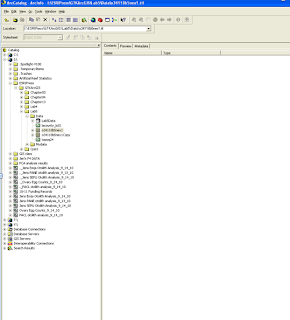
2a. The feature datasets are called “basemap” and “hydrology”
2b. The feature classes are NHDFlowline, NHDPoint, NHD Waterbody, and Watersheds
2c. NHDFlowline: line, NHDPoint: point, NHD Waterbody: polygon, and Watersheds: polygon
3a. Vector layer (metadata: description: expand data storage and access information: type of data)
3b. vector layer feature class, specifically a shapefile
3c. Yes
3d. Vector feature class
3e. Yes
3f. 3 keywords: hydrography, stream/river, and lake/pond
3g. Earth Science Information center, USGS
4. yes
6b. 34118-B5
7. black and white
8.

10.
12a. The lacount_lu01.shp layer was grayed out and had a red exclamation point next to it because it couldn’t find the data source
12b. To redirect the layer to the new data source name I right-clicked on the layer and selected properties. Then, I selected the source tab, set data source, and finally the lab 5 data folder and the correct data source.
No comments:
Post a Comment